After the Belfast Group stopped meeting in 1972, many participants downplayed its importance to the development of their writing. Regardless of its ultimate impact, the writing workshop nevertheless connected many authors in Northern Ireland. The pages linked above visualize these networks of relationships, as well as the writers’ connections to specific places.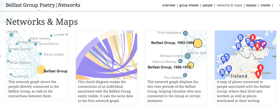
About the Project
(excerpted from the project website)
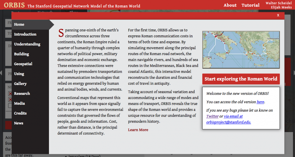
The Stanford Geospatial Network Model of the Roman World reconstructs the time cost and financial expense associated with a wide range of different types of travel in antiquity. The model is based on a simplified version of the giant network of cities, roads, rivers and sea lanes that framed movement across the Roman Empire. It broadly reflects conditions around 200 CE but also covers a few sites and roads created in late antiquity.
Hypercities (best viewed in Chrome)
 Collaborative research and teaching platform for developing “deep maps” of selected cities
The Map of Early Modern London
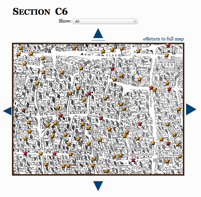 “The Map of Early Modern London is comprised of four distinct, interoperable projects: a digital Map and gazetteer based on the 1560s Agas woodcut map of London; an Encyclopedia of London people, places, topics, and terms; a Library of marked-up texts rich in London toponyms; and a versioned edition of John Stow’s Survey of London.
These four projects draw data from MoEML’s five databases: a Placeography of locations (e.g., streets, sites, playhouses, taverns, churches, wards, and topographical features); a Personography of early modern Londoners, both historical and literary; an Orgography of organizations (e.g., livery companies and other corporations); a Bibliography of primary and secondary sources; and a Glossary of terms relevant to early modern London. All of the files in our databases use a common TEI tagset that enables us to work with primary and secondary texts simultaneously.”
Jenstad, Janelle. n.d. “About MoEML.” The Map of Early Modern London. Ed. Janelle Jenstad. Victoria: University of Victoria. Accessed August 24, 2014. http://mapoflondon.uvic.ca/about.htm.